


10 years on from the North Sea storm surge which brought the worst coastal flooding for 60 years
A look back on the North Sea storm surge which brought flooding to eastern coastal communities, 60 years after the Great North Sea Flood of January 1953.
It was the 10th anniversary on the 5th December of a storm that brought a storm surge down the North Sea - bringing coastal flooding to eastern England and also Netherlands and northern Germany.
Between the 5-6th December 2013 large areas of the east coast of England were affected by coastal flooding on a scale not seen since the Great floods of 1953. A combination of factors led to the storm surge that was responsible for flooding. This included a high spring tide, an area of low pressure and strong northerly winds.

A deepening depression, named Storm Xaver, developed off the southeast Greenland coast on 3rd December 2013 and moved eastwards towards the UK. On 5th December, the storm passed north of Scotland and merged with another low-pressure system located over the Norwegian Sea. The pressure dropped rapidly to 960 hPa as the storm crossed the North Sea, before it passed over southern Norway and Sweden, where pressure dropped to 959 hPa, reaching its lowest pressure over the Baltic Sea, before passing over Eastern Europe. Hurricane force wind gusts were recorded, with a gust of 140mph on Aonach Moor mountain in the Highlands, gusts of 92mph were recorded in northern Germany, with mean wind speeds of 57mph recorded in the North Sea.
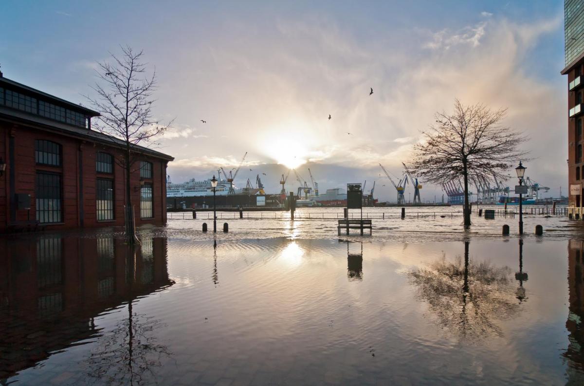
The combination of low pressure (causing the sea level to rise), high spring tide, gale force winds increasing wave height and coastal squeeze towards the southern North Sea drove a significant storm surge which caused flooding along the coasts of England, Netherlands and northern Germany.
The continental shelf sea of the southern North Sea is susceptible to storm surges, narrowing to a restricted connection with the English Channel and being relatively shallow compared to the deeper North Sea basins to the north. This geography thus funnels waves, generated by strong northerly winds brought by vigorous eastward-tracking depressions, onto low-lying coastal margins. When such wind and wave forcing coincides with high spring tides there is the potential for coastal erosion, accompanied by extensive sea flooding.
Tides were nearly 2 metres above their usual levels and there were significant wave heights of 4m near the coast of England, rising to 8m on the coast of Norway, with a maximum of 9m in the middle of the North Sea. Record storm surges were measured in the Wadden Sea, the barrier islands along the north of the Netherlands and the northwest of Germany.
36 Severe Flood Warnings were issued for coastal areas of East Anglia, with thousands ordered to evacuate their homes, as houses toppled into the sea by the coast in Norfolk, Suffolk and Essex.
Across Northwest Europe, by 7th December 2013, Storm Xaver had left 15 people dead and dozens injured. There were no reported fatalities from coastal flooding though. Initial estimates from the Environment Agency (EA) indicated consequences including seawater inundation to 1,400 homes, 1,000 businesses and 3,200 hectares of farmland. Over 10,000 people were evacuated along the east coast, and approximately 800,000 properties are reported to have been protected by flood defences along 2,800 km of UK coastline. Around 2,800 properties were flooded across the UK.
The coast of East Anglia is particularly prone to erosion, as the cliffs along some its length are made of soft rock, such as clay, which are easily washed away by the sea. So, cliff top homes are particularly prone to falling into the sea.
Sea defences have been vastly reinforced since the Great North Sea Flood of 31st January1953 – nearly 71 years ago, the worst natural disaster Britain experienced during the 20th century, when the low-lying housing of England’s east coast was devastated by a huge tidal surge, which left 307 people dead and 40,000 homeless.
That devastating event revealed the inadequacy of coastal defences then in place and led to Britain’s largest sea defence improvement program. In the following years, defences were raised by up to 2 m (6.5 feet) and strengthened around population centres. The Thames Barrier was also built near Woolwich and opened in 1982 to protect London upriver from flooding from tidal and storm surges. In the Netherlands an extensive system of dams and storm surge barriers known as the Delta Works were developed.
The improvements to coastal flood defences since 1953 have significantly reduced the risk of such a flood occurring again today, but there are still stretches of coastline away from population centres which are exposed with little or no sea defences. While rising sea levels from global warming melting ice sheets in the polar regions could increase the risk of coastal flooding from future storm surges, despite the improvements to defences.
Top photo - flooding in Hamburg caused by Storm Xaver
Check Your Latest Local Weather Forecast
More Weather Forecasts & News
Site Search